 Today was a very different day than yesterday. No precipitation occurred (at least at the time of this post). The precipitation and deep clouds associated with the atmospheric wave of yesterday moved eastward, leaving us in the morning with layered mid to upper level clouds. These can be seen in this picture taken near the S-Pol site. The water and sand also look inviting!
Much of the talk today involved the development of an area of precipitation and deep clouds to the west of us in the western Indian Ocean, which can be seen in this satellite image (an infrared satellite image for those in the know). This feature also seems to be accompanied by some rotation off the equator that is very intriguing. Is this the start of the MJO? If so, what confluence of events caused the development of this initial MJO precipitation area? If not, what else is responsible for this blowup of precipitation?
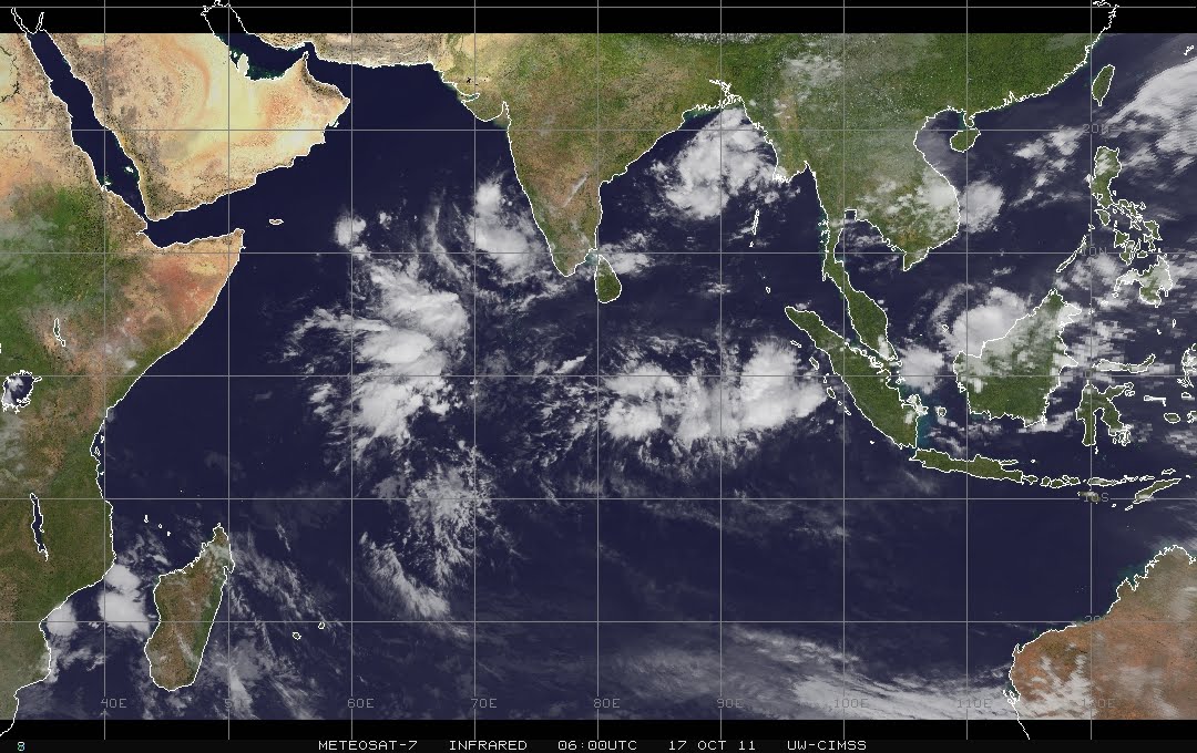
Some of the answers to these questions may become clear in the next several days, although the answers to the others may require years of study of DYNAMO observations and models. Regardless, the changing weather to the west provided some stunning scenes that made everyone wonder what we will wake up to tomorrow.

No comments:
Post a Comment