While scientists are converging on the Indian Ocean, a small team of forecasters from the NOAA Climate Prediction Center (CPC), University of Albany (SUNY), the Centre for Australian Weather and Climate Research (CAWCR), and the Cooperative Institute for Climate and Satellites (CICS) are busy monitoring and creating short-term climate forecasts for the global tropics. This weekly assessment helps the DYNAMO campaign prepare for MJO events, so accurate measurements can be gathered.
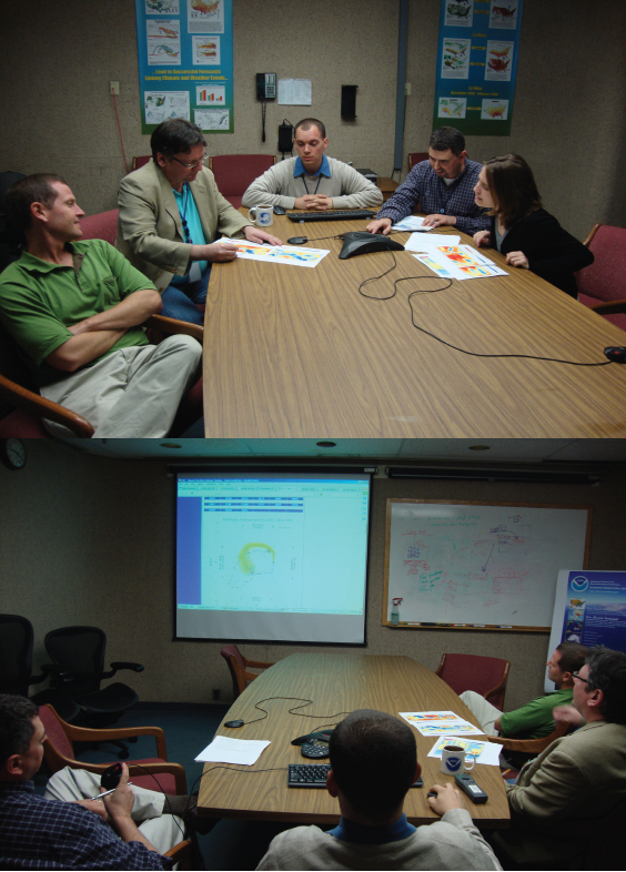
Led by Jon Gottschalck, the team of Paul Roundy, Matt Wheeler, Carl Schreck, Matt Rosencrans, Augustin Vintzileos, Michelle L’Heureux, and others come together each Monday via teleconference to discuss the latest observations over the Indian Ocean DYNAMO array and the rest of the global tropics (primarily from 30°N to 30°S). The goal is to generate a short assessment of which tropical climate patterns, or “modes,” are influencing regions of precipitation and tropical cyclogenesis during the next one-to-two week period. This discussion leads to the generation of the “Global Tropical Hazards/Benefits Outlook.”
http://www.cpc.ncep.noaa.gov/products/precip/CWlink/ghazards/index.php

 In order to understand the phenomenon and their impacts, the team considers the observations, such as outgoing longwave radiation (OLR) and low-level and upper-level winds, and examines them from several different perspectives (see the previous posting “On the Hovmoeller plot”). They also consider many different forecast tools, based on dynamical models (observations are ingested and equations are solved on large supercomputers) and statistical models (conceptually simpler models based on historical observed relationships). Many scientists on the team have developed web-based resources to help guide the forecast discussion:
http://www.cpc.ncep.noaa.gov/products/precip/CWlink/MJO/mjo.shtml
http://cawcr.gov.au/staff/mwheeler/maproom/RMM/
http://www.atmos.albany.edu/facstaff/roundy/waves/
http://monitor.cicsnc.org/mjo/current/
The MJO can affect the circulation over the entire globe including the higher latitudes, such as the United States, which is sometimes discussed during the teleconference. Many of the forecasters are currently working with other researchers to investigate how they can use information from the MJO and other tropical waves to improve short-term climate prediction (weeks out to a month) across the globe. Even after the DYNAMO field campaign is over, the MJO briefing and Global Tropical Hazards/Benefit Outlook will continue, and so the team is excited about the potential for the DYNAMO field campaign to new generate insights and breakthroughs that will help improve climate prediction.
Great post, Michelle! Thanks for the contribution. We appreciate all your team has been doing.
ReplyDeleteNice one Michelle.
ReplyDeleteBTW: the Australian Bureau of Meteorology now has an operational spiderweb/RMM diagram thingy - see: http://www.bom.gov.au/climate/mjo
Very nice webpage! I really like the tabs that allow you to compare the current MJO state and OLR anomalies with the MJO composites. For instance, during the last 7 days there appears to be wetter conditions (negative OLR) across northern Australia, which is also suggested by the MJO composites in Phases 6-7.
ReplyDeleteThe U.S. equivalent is here:
http://www.cpc.ncep.noaa.gov/products/precip/CWlink/MJO/Composites/Temperature/
http://www.cpc.ncep.noaa.gov/products/precip/CWlink/MJO/Composites/Precipitation/
As documented in:
Zhou S., L'Heureux M., Weaver S., Kumar A. (2011) A composite study of the MJO influence on the surface air temperature and precipitation over the Continental United States. Clim Dyn.doi:10.1007/s00382-011-1001-9.
Hey Michelle, is there anyway for curious bystanders to eavesdrop on these MJO forecast teleconferences? I'd love to be a fly on a wall of an expert discussion, as I'm spinning up on a new postdoc project at UW that will involve trying to hindcast DYNAMO conditions with a special type of GCM.
ReplyDelete